

Hiking Seceda in the Dolomites: A No-Nonsense Guide to Italy’s Most Famous Ridge
Seceda is the postcard image of the Dolomites, but there is more to the area than just a quick photo for social media. Located in the Val Gardena region at an altitude of 2,519 metres, the Odle peaks (also known as the Geisler group) are a proper sight to behold. While it is undeniably one of the most visited spots in South Tyrol, it is also one of the few places that actually manages to look better in person than it does on a screen.
When to Visit: Autumn Peace vs. Summer Buzz
We headed up in October, and if you can swing an off-season trip, I’d highly recommend it. You miss the worst of the crowds and get those deep autumn colours in the trees.
That said, if you’re planning a trip for July or August, don’t think you’ve missed out. Summer in the Dolomites is still magnificent. The alpine meadows are bright green, the wildflowers are out in force, and you have much longer daylight hours.
Summer is glorious but undeniably busy. You’ll be sharing the ridgeline with plenty of other hikers and the cable car queues will be longer.
October is quieter and cooler, but you do run the risk of an early snowfall closing the paths. Either way, the view at the top doesn’t change; it’s just a case of whether you’re happy to join the summer crowds for the buzz or if you’d rather have the trail a bit more to yourself.
Seceda Hike at a Glance:
Distance: 19 km
Difficulty: Moderate. The trails are well-marked, but there are some steep uphill sections.
Time: 6.5 hours
Total Ascent: 1,188m
If you’re heading up in the autumn like we did, the trails can get quite slippy in parts so wear sturdy, waterproof hiking boots with a good grip.
Getting Started: Parking & Logistics
We started our hike from the Cristauta (Praplan) car park. Parking costs €8 per day (cash only). However, in October it’s free.
Finding the Start: You can find the exact location of the car park on [Google Maps here].
I’d highly recommend making a pit stop for a coffee and a toilet break in the town of Santa Cristina before you start the drive up the mountain as there are no toilets in this carpark.
A Pro-Tip for Summer Visitors
This is a relatively small mountain car park. If you’re planning to do this in July or August, I imagine it reaches capacity before most people have even finished their breakfast. You’ll want to arrive extremely early, well before 8:30am to secure a space.
The Route: From Praplan Car Park to Seceda
The trail starts directly from the car park. You want to follow the signs for Trail 4, which is clearly marked for both Col Raiser and Seceda.
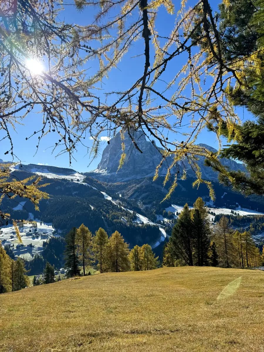
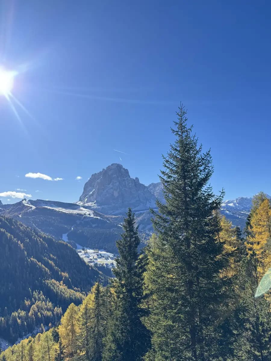
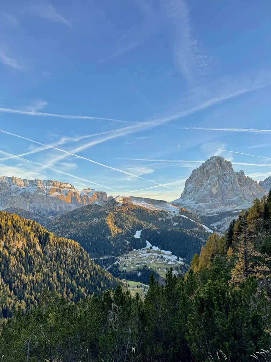
The first leg of the hike takes about 1.5 hours on a steady uphill path. As you climb, the views start to open up over Val Gardena. You will get a brilliant look at Sassolungo (Langkofel), which stands at 3,181m. It is easily my favourite mountain in the valley; it is a massive, jagged block of rock that looks like something out of a film.
When you reach the top of this section, you will come out at Col Raiser. You will see the top station of the cable car here. This lift actually comes up from S. Cristina, whereas those starting in Ortisei take a direct cable car straight to the summit ridge. You will also see the Almhotel Col Raiser right there, though it was closed when we visited in October. It is a great spot to take a breather because the view looking back over the valley from here is absolutely amazing.
Navigating From Col Raiser To The Ridgeline
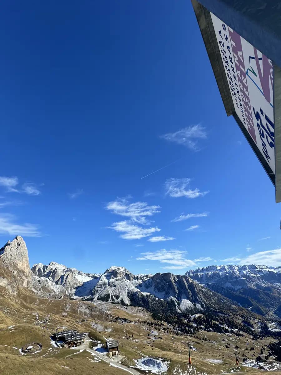
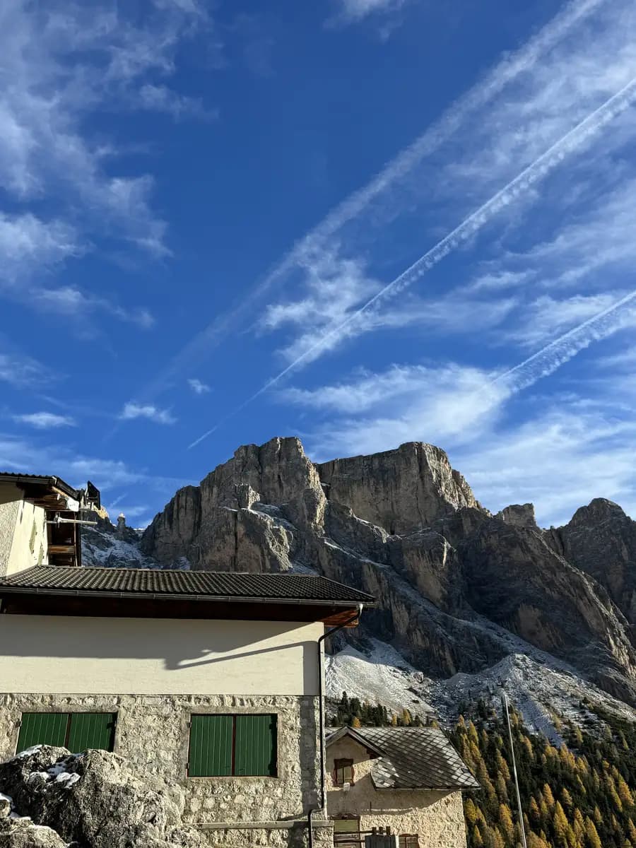
From the open area behind the Col Raiser Hotel, the landscape opens up and you will see paths branching off to both the left and the right. Look for a rifugio called Malga Odles. This one was open when we passed through and is a very handy stop, as there are toilets available inside if you need them before you continue.
To the left of the Malga Odles building, you will see a large billboard showing which paths are currently open or closed. You want to follow the path directly to the left of this sign and the rifugio. You are now looking for Trail 1, with signs pointing toward Seceda or Troier Hütte.
The Final Push: Summiting Vs. The Iconic Viewpoint
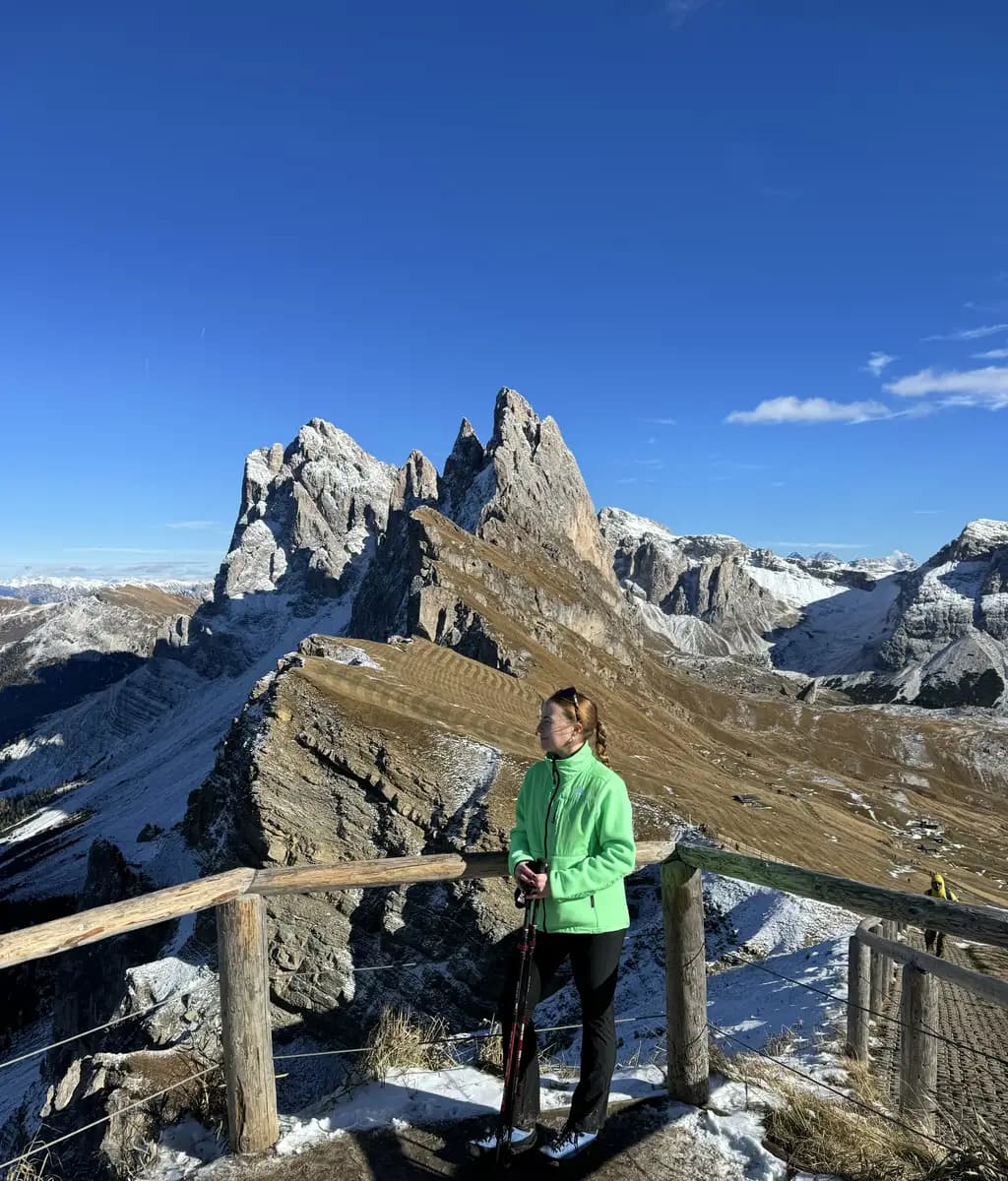
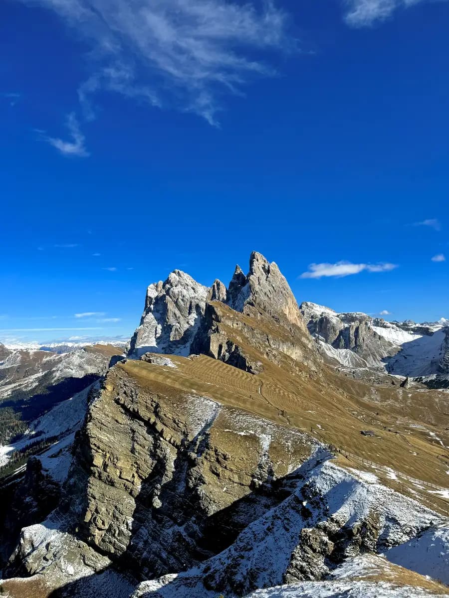
As you near the top, the trail presents you with a bit of a choice. You will see the path continuing toward the Seceda cable car station in the distance, and a sharp right turn that leads up to the edge of the ridgeline. We took the right turn, thinking it would lead us straight to that famous viewpoint, but we quickly realised we were standing on the summit of Seceda itself.
While standing on the peak is impressive, there is a catch. Because you are actually on top of the ridge, you cannot properly see the iconic viewpoint that everyone comes here to photograph. However, the 360-degree views are amazing. You get a fantastic look down into Val di Funes and the Geisleralm meadows below. It is a perspective of the Odle peaks that most people miss, and it really shows you just how steep the drop-off is on the other side.
Avoiding The €5 Toll Path
From the summit, you will see another path stretching straight across toward the classic viewpoint area. However, be aware that there is a gate here where they charge you €5 just to cross.
If you would rather not pay the fiver, the fix is simple. Just head back down the small path you came up and follow the main trail toward the cable car station. This is where you get that iconic shot of Seceda.
The Descent: A Scenic Loop Via Pieralongia And Rifugio Firenze
We decided to take a different route back down to keep things interesting rather than just retracing our steps. From the Seceda ridge, we followed the signs pointing toward Rifugio Firenze (which you will often see marked as the Regensburger Hütte). This turns the hike into a proper loop and takes you through some of the most dramatic terrain on the mountain.
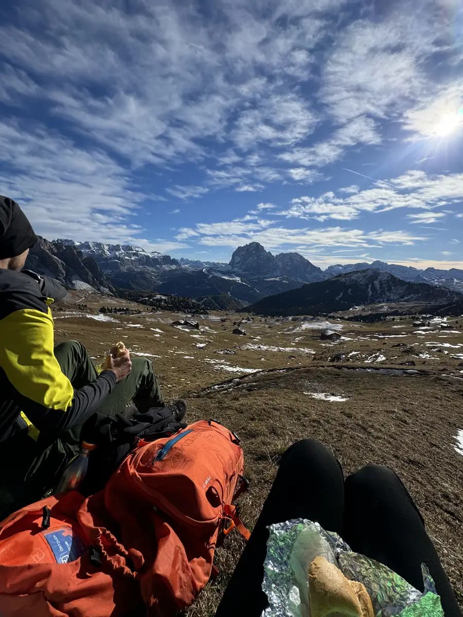
The Best Lunch View In The Dolomites
We had high hopes of eating our packed paninis at the very top of the ridge, but even in the sun, the wind at that altitude in October was freezing. If you’re heading up, don’t underestimate the temperature drop. You’ll likely want to descend a bit before you even think about taking your gloves off to eat.
About 40 minutes into the descent, we finally found a large, flat rock that was sheltered from the wind. It offered, without any exaggeration, the most breathtaking lunch view I have ever had.
It just goes to show that you do not always need to be at the summit to find the best spot on the mountain. Sometimes, getting out of the wind and finding a bit of peace is worth much more, especially when your hands are starting to get a bit numb.
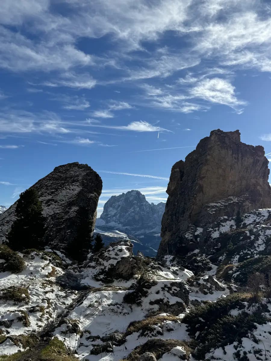
Passing The Pieralongia Twin Spires On Path 13
From our lunch spot, we continued along the path. On the way toward the rifugio, you pass the amazing Pieralongia Twin Spires. These are two massive, jagged rock needles that sit right in the middle of the meadow. In which you can see the Sassolungo mountain in the middle of the rocks in the background.
After following the initial signs for Trail 1 or the rifugio, you need to take Path 13 to enter the Pieralongia area. It is a well-marked route that leads you right past the spires. After a bit more walking, you will eventually reach the Rifugio Firenze. It is a great way to see a more rugged, quiet side of the mountain before you finish the loop.
When we reached Rifugio Firenze, it was closed. It is a very good idea to check the opening times for all the rifugio’s along the trail before you set off.
Final Leg: Returning Malga Odles For A Well-Deserved Drink
From the rifugio, we looped back around toward Col Raiser to finish our loop. We decided to stop at Malga Odles for a a well-deserved Hugo Spritz and a cold beer. It is a fantastic spot to just sit back and take in the views one last time before you head back.
If you would like to see more details and a few extra pictures of the descent, you can check out the video I put together on TikTok.
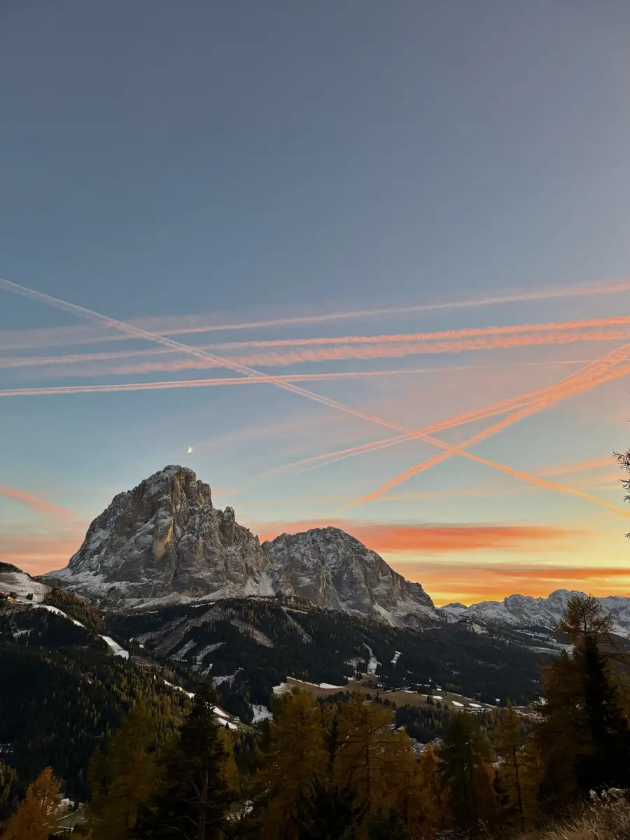
The Best Sunset of the Trip
As we were getting ready to leave Malga Odles, the sun was starting to set. This was quite possibly the best sunset I have ever seen. The entire sky above the Val Gardena turned these deep shades of orange and pink. It’s one of those moments where you stop complaining about your tired legs and realise why people fly across the world just to stand in this one specific valley.
We were so busy looking at the sky that we managed to miss the turn for the car park entirely. Before we knew it, the light was fading fast and we were wandering through the woods. We had to do a bit of a frantic run back once we realised we were on the wrong path! To make sure you don’t do the same:
Look for the Gate: Once you’ve come down from the Col Raiser area, you’ll pass through a small gate near the end of the trail.
Find the Bench: Look for a wooden bench on your left.
The Signpost: There is a signpost on the right, follow the direction for the car park to the right.
In My Rucksack: Packing for the Peaks
October in the Dolomites is a mixture of all four seasons. One minute it’s breezy and cold and the next you are warm in the sun. I highly recommend “The Onion Method”—lots of thin, high-quality layers that you can peel off or pile on as the weather shifts.
The Layering System: I wore body warmers from both UNICLO and Primark.
For my fleece, I used [The North Face Denali Jacket]. It’s a classic for a reason—it’s properly warm without being too bulky to fit under a shell. I went for the Chlorophyll Green which looked fantastic against the autumn colours, but more importantly, it kept me warm at the summits.
Your top layer needs to be a shield. I used [The North Face Diablo Dynamic Jacket]. It’s a solid, reliable rain jacket that is completely windproof and waterproof. It’s lightweight enough to shove into your pack when the sun comes out, but heavy-duty enough to handle a proper mountain downpour.
Sturdy Hiking Boots: You need something waterproof with a good grip. The trails on Seceda, Mount Pic and Adolf Munkel are slippery, especially if there’s a bit of morning frost or loose scree. I’ve been wearing [The North Face Verto GORE-TEX Alpine Mid Boots] and they have been a game-changer. They have a Vibram sole which is fantastic for gripping and the Gore-Tex lining is a lifesaver when you inevitably end up crossing muck and snow.
The Break-in Tip: If you’re getting a fresh pair for your trip, wear thick socks for that first outing and keep a few Compeed plasters in your bag just in case. Mine needed that initial hike to soften up, but once they were worn in, they were very comfortable. Now, I can spend all day in them without a second thought.
The Accessories: Bring gloves, a warm hat (beanie), and sunglasses. Even on a blue-sky day, the wind at the ridgelines is sharp. The high-altitude glare is also incredibly strong, so your eyes will thank you for the protection.
Planning the Rest of Your Dolomites Trip?
Seceda was Day 2 of our mountain escape, but the trip didn’t end there. If you want to see where we headed next—including a few spots that are even more peaceful than the Seceda ridgeline—you can find the rest of my itinerary: 6-Day Val di Funes Itinerary: The Heart of the Dolomites.